Utilizing two-dimensional three-component PIV (2D3C PIV) technology, visualized measurements of water-sediment flow fields under open channel, partially ice-covered, and fully ice-covered conditions were conducted. The study reveals the influence of ice cover boundaries on velocity distribution, local vortex structures, and sediment particle migration, providing an experimental basis for water-sediment regulation during the ice period of the Yellow River and research on the resilience of agricultural soil-water habitats in cold regions.
The 2026 Annual Academic Conference of Agricultural Soil and Water Engineering in China, themed “High Water-Efficiency Agriculture and Green Development,” established topics such as “Regulation and Resilience Enhancement of Agricultural Soil-Water Habitat” and “Optimal Allocation and Efficient Utilization of Soil and Water Resources.” Among these, “Regulation and Resilience Enhancement of Agricultural Soil-Water Habitat” is highly correlated with the evolution of water and sediment in rivers in cold regions during the ice period. After the formation of an ice cover, the upper boundary conditions, near-bed shear action, sediment incipient motion conditions, and local sediment transport capacity all change, affecting channel stability, ice flood safety, and regional soil and water resource regulation.
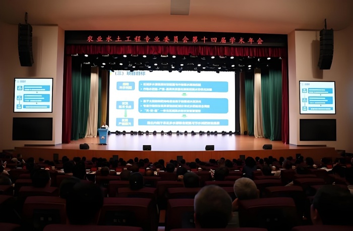
Figure 1 - Scene of the 2026 Annual Academic Conference of Agricultural Soil and Water Engineering in China
The Ningmeng Reach of the Yellow River experiences long freeze-up durations in winter, making the river channel prone to issues such as ice jams and sediment deposition. The ice cover alters the flow velocity distribution and resistance structure; these hydrodynamic changes further influence the processes of sediment incipient motion, suspension, bed load transport, and deposition, while riverbed morphology adjustments react upon the local flow field. The resulting ice-water-sediment coupled transport process is a fundamental issue affecting the stability of the Yellow River channel and water resource regulation in winter.
Existing research mostly relies on theoretical analysis, CFD numerical simulations, and point-wise velocity measurement methods. Although theoretical models and Computational Fluid Dynamics (CFD) methods help describe macroscopic evolution laws, their results depend on boundary conditions, turbulence models, and particle transport parameters. While traditional point-wise instruments can obtain local flow velocities, they struggle to fully present transient flow field structures in areas such as the leading edge of the ice cover, the lee side of sand dunes, and the near-bed layer.
Therefore, Inner Mongolia Agricultural University introduced the Revealer two-dimensional three-component PIV (2D3C PIV) technology to track the entire process of sediment particles at the particle scale—from incipient motion and suspension to transport. It quantitatively studies the influence of vertical velocity distribution and changes in near-bed turbulence structures under ice cover boundary conditions on the incipient probability and transport paths of deposited sediment particles.
The main purpose of the experiment is to verify the feasibility of using 2D3C PIV measurement methods for water-sediment flow field measurements under open channel and ice-covered conditions, and to compare the effects of different ice cover states on flow field structures and sediment particle motion, identifying typical flow structures to provide an experimental basis for subsequent research on ice-water-sediment coupling mechanisms.
The experiment set up three typical working conditions: open channel, partially ice-covered, and fully ice-covered. The open channel condition serves to characterize the basic state of water-sediment movement under free surface conditions; the partially ice-covered condition is used to simulate local freezing or the ice cover development stage, focusing on observing the flow transition at the junction of the free surface and the fixed ice cover; the fully ice-covered condition characterizes the flow features constrained by both upper and lower boundaries. By comparing velocity vector maps, velocity contour maps, streamline maps, and particle motion parameters of the three conditions, the influence of the ice cover boundary on velocity distribution, local vortex structures, and sediment migration status is analyzed.
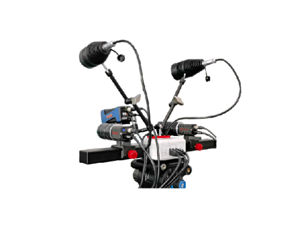
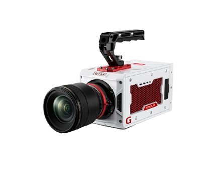
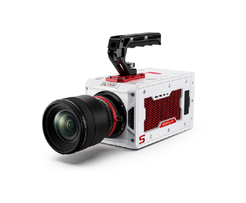
The experiment was carried out relying on the open channel experimental platform of Inner Mongolia Agricultural University. The 2D3C PIV measurement system consists of 2 high-speed cameras, a continuous laser, a calibration device, tracer particles, and synchronous acquisition and flow field analysis software. The 2 high-speed cameras are Revealer X150M models, with an image resolution/frame rate of 2560×1920@2000 fps, and a test frame rate of 1000 fps. The illumination system is a 20 W continuous laser, which shapes the laser into a sheet light to illuminate the measurement area. The experiment used particles with a diameter of 50~100 μm as objects for identifying flow and sediment movement. Image data was processed through RFlow4 software to complete calibration, image preprocessing, velocity field calculation, and result visualization.
In stereoscopic PIV, two cameras observe the same laser measurement plane synchronously from different angles, establishing a mapping relationship between image coordinates and physical space coordinates through stereo calibration. After completing the calibration of the camera’s internal and external parameters, the three-component velocity within the measurement plane is reconstructed using particle displacement information obtained by the two cameras, allowing for the analysis of out-of-plane motion induced by the ice cover boundary.
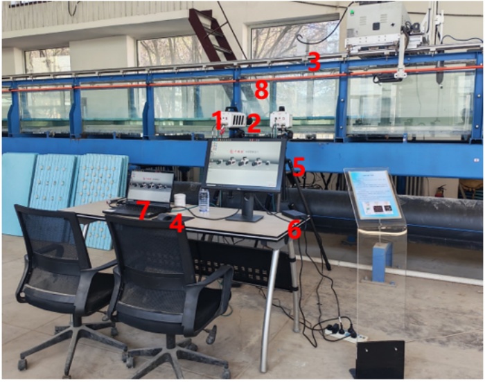
Figure 2 - Layout of 2D3C PIV system coupled equipment (1-High-speed camera, 2-Lens, 3-Laser, 4-Calibration device, 5-Tracer particles, 6-Auxiliary bracket, 7-Workstation, 8-Experimental open channel)
The experiment revolves around three typical upper boundary conditions. Under open channel conditions, the water surface remains in a free state, and the flow field is mainly controlled by gravity, bed friction, and sand bed morphology. Under partially ice-covered conditions, both a free surface and a fixed ice cover exist simultaneously in the measurement area, and the upper boundary condition undergoes a sudden change along the flow direction. Under fully ice-covered conditions, the water flow is constrained by both the ice surface and the sand bed, forming an approximately closed water flow channel.
All three conditions focus on the area adjacent to the sand bed, the velocity distribution near the windward and leeward sides of the sand dune, and simultaneously observe phenomena of particle incipient motion, migration, deceleration, and retention. Since the number of test samples in this experiment was limited, the result analysis focuses on qualitative comparison, and no statistical inferences are made regarding sediment transport rate, critical incipient velocity, and particle size sorting laws between various conditions.
The difficulty of calibration in sand bed experiments lies in the fact that the undulation of the bed surface will block part of the calibration plate area and cause inconsistency between the calibration plane and the actual measurement plane. In the experiment, the height of the sand bed in the measurement area was first lowered to complete calibration under unobstructed conditions, then the sediment was backfilled to the specified position, and the local bed surface was leveled before testing, thereby reducing the impact of the sand pit on imaging and calibration. This method ensures the complete identification of feature points on the calibration plate and improves the reliability of velocity field reconstruction in the near-bed area.
Addressing issues such as the turbidity of the Yellow River sediment medium, large differences in particle reflection, and the influence of ice surface ripples on sheet light propagation, the experiment involved cleaning, screening, and size grading of the sediment. Image enhancement, background suppression, and threshold segmentation were used to improve particle identification effects. The overall water flow velocity field was solved using the PIV cross-correlation method; for larger sediment particles that could be identified independently, the PTV method was used to extract their position, particle size, velocity, and acceleration information. PIV is used to describe continuous flow field structures, and PTV is used to supplement discrete particle motion characteristics; together, they constitute a water flow-particle collaborative analysis method.
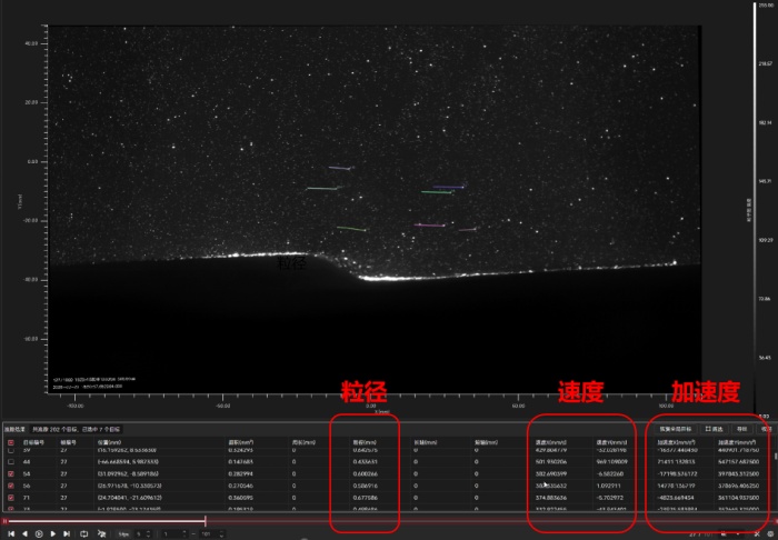
Figure 3 - Sediment particle diameter, X/Y direction velocity, and acceleration calculated using the PTV module of Revealer RFlow software
The velocity vectors are arranged along the channel direction overall, and the mainstream direction is relatively clear. The vector length in the area near the sand bed is relatively short, gradually increasing with the rise of the vertical position, reflecting the velocity gradient caused by bed friction. The velocity contour map shows that the middle and upper layers are relatively high-speed zones, while a continuous low-speed zone forms in the near-bed layer. After the water flow passes over the top of the sand dune, a velocity drop and local backflow occur on the leeward side.
The streamline map further indicates that the streamlines on the windward side of the sand dune gradually rise, separate after passing the dune crest, and form a local vortex on the leeward side. This recirculation zone has a weak average transport capacity; moving particles entering it tend to decelerate, stop, or deposit. The particle identification results are basically consistent with the flow field characteristics: particle activity in the near-bed high-shear area is relatively obvious, while particle migration speed on the back of the sand dune decreases. The water-sediment movement under open channel conditions is mainly controlled by the bed topography and free surface flow, with local “windward scouring-leeward deposition” features being prominent.
The velocity field presents obvious spatial transition characteristics. The velocity vectors in the non-ice-covered area are longer, while the vector length decreases after entering the ice-covered area, and the direction also undergoes local adjustment. The velocity contour map shows that the high-speed zone is mainly distributed in the free surface section and near the ice cover leading edge.
The streamlines undergo compression, deflection, and reorganization at the starting position of the ice cover, indicating that the conversion from the free surface boundary to the fixed ice cover boundary significantly changes the local momentum distribution. Compared with the open channel condition, the non-uniformity of the flow field under the partially ice-covered condition is stronger, and a large velocity gradient and local disturbance may form at the leading edge of the ice cover. Particles are more easily carried by the water flow in the non-ice-covered section, while movement tends to slow down after entering the ice-covered section; some particles may stagnate due to decreased transport capacity.
The velocity vectors in the velocity vector map are relatively short in the areas near the ice surface and near the bed surface, and relatively long in the middle water layer, forming a “low at top and bottom, high in the middle” velocity distribution. The velocity contour map indicates that the overall high-speed zone range is significantly reduced and concentrated in the middle of the water layer; both the near-bed and near-ice surface areas appear as low-speed zones.
The streamlines mainly unfold along the middle flow passage area, being more concentrated than under open channel conditions. The recirculation structure on the leeward side of the sand dune can still appear, but the flow intensity is collectively weakened. Particle identification results show that both the activity range and motion intensity of sediment particles have decreased, and phenomena of continuous suspension and rapid migration are reduced. This result indicates that under the joint constraint of upper and lower boundaries, the ice cover not only changes the velocity profile but also weakens the momentum input to the near-bed area, having a certain inhibitory effect on sediment initiation and resuspension.
The three conditions reflect the process of the flow field transitioning from free development to constrained transport as the ice cover boundary gradually strengthens. Under open channel conditions, the flow field is strongly controlled by sand bed morphology, and recirculation on the leeward side and sediment retention are relatively obvious; under partially ice-covered conditions, the upper boundary changes suddenly along the flow direction, and the velocity distribution and streamline structure are the most non-uniform; under fully ice-covered conditions, the mainstream area contracts toward the middle, and the overall flow intensity and near-bed particle activity weaken.
From the perspective of velocity field structure, the main effect of the ice cover is to redistribute the momentum within the water layer. As the ice cover range increases, the high-speed area gradually changes from a wide distribution in the middle and upper layers to a concentrated distribution in the middle, and the near-bed shear and sediment transport capacity change accordingly. From the perspective of particle response, open channel conditions are more favorable for particle initiation and redistribution, partially ice-covered conditions exhibit an obvious spatial zoning effect, and particle motion tends to slow down overall under fully ice-covered conditions.
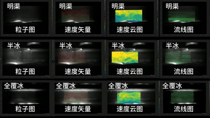
Figure 4 - Original particle images captured by X150 high-speed cameras, and post-processing calculated velocity vector maps, velocity contour maps, and streamline maps under open channel, partially ice-covered, and fully ice-covered conditions
This study conducted experimental measurements of water-sediment flow fields under open channel, partially ice-covered, and fully ice-covered conditions based on Revealer 2D3C PIV technology. The results show that:
I. The three upper boundary conditions formed velocity distributions and streamline structures with obvious differences. The open channel flow field is obviously controlled by sand bed morphology, and it is easy to form recirculation and particle retention on the back of sand dunes; under partially ice-covered conditions, the high-speed zone contracts toward the middle of the water layer, and near-bed flow and particle activity generally weaken.
II. The collaborative analysis of PIV and PTV can simultaneously provide continuous water flow velocity fields and discrete particle motion information, which is suitable for the experimental observation of the ice-water-sediment coupled transport process. It can provide new experimental means for the study of water-sediment movement in rivers in cold regions.
III. Subsequent research can further introduce three-dimensional three-component Particle Image Velocimetry (PIV) technology (3D3C PIV) and three-dimensional Particle Tracking Velocimetry (PTV) technology to analyze the complete three-dimensional vortex structures along the flow direction and spanwise direction in the ice-water-sediment coupled transport process.
NEXT
 English
 Deutsch